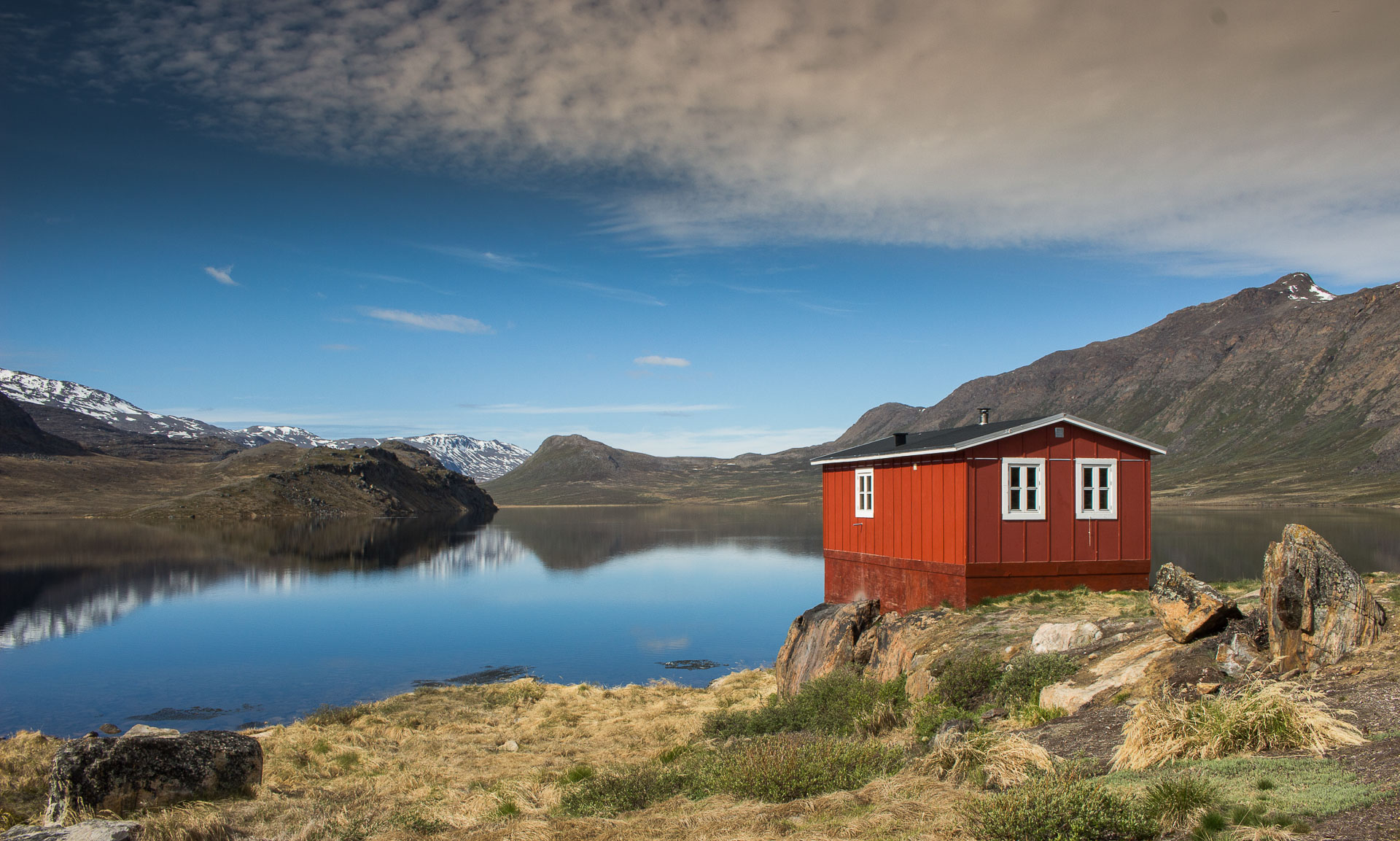
Arctic Circle Trail – Výjmečný dálkový trek v odlehlé Grónské přírodě. Přes 160 km v obtížném terénu, plavání v jezerech s krystalicky čistou vodou a spaní ve stylových Grónských chatičkách. Dechberoucí a nezapomenutelná zkušenost mimo dosah civilizace.


Arctic Circle Trail je dálková pěší stezka v Grónsku, která se táhne mezi městy Kangerlussuaq a Sisimiut. Jak už název stezky napovídá, tento trek leží těsně za polárním kruhem a ani polární kruh nemá ve skutečnosti pevně stanovenou zeměpisnou šířku, obecně je přijímána hodnota 66° 33’s.š.. V závislosti na tom, odkud se vydáte, vás tato nezapomenutelná expedice povede asi 160-180 km grónskou divočinou. Běžně trénovaní trekaři tuto vzdálenost obvykle překonávají za 10-12 dní, ale my jsme ji zvládli za 8 dní a podle referencí místní Inuité tento „výlet“ obvykle absolvují za zhruba 5 dní. Během tohoto uklidňující období budete vystaveni syrové přírodě daleko od civilizace a pečlivá příprava je naprostou nutností! Mohou nastat dny, kdy nepotkáte ani jednoho člověka, a po celou dobu cesty musíte být naprosto soběstační, takže buďte připraveni. Rád bych vám v tomto článku poskytl kompletní sadu znalostí a tipů, abyste si cestu maximálně užili, a také popsal naši cestu, jak jsme tuto odlehlou arktickou oblast prošli.
Vybavení:
Stan: To je naprostá nutnost, nikdy nevíte, co se na cestě stane a jaké počasí vás potká. Chaty po cestě mohou být plně obsazené a stanování bude jedinou možností, jak přežít noc.
Kuchyň: Pokud nechcete cestou jíst jen oříšky a chleba, plně doporučuji vzít si s sebou vařič, hrnec a lžíci spolu se sušenými potravinami, abyste si mohli uvařit něco dobrého a uvařit si cestou čaj nebo kávu. Chaty po cestě nemají obsluhu a uvnitř není žádné jídlo/kuchyň.
Mapy/GPS: Přestože je ACT díky většinou velmi zřetelné stezce velmi snadno navigovatelná, budete určitě potřebovat alespoň papírové mapy nebo GPS. Grónské turistické sdružení vytvořilo pro tuto túru tři mapy: „Sisimiut“, „Pingu“ a „Kangerlussuaq“. Já osobně jsem se spoléhal na GPS, která byla dostačující a připravil jsem pro vás google mapu se základními waypointy, takže si ji můžete otevřít a stáhnout ZDE. Soubor GPS pro stezku Arctic circle ke stažení ZDE. Podél cesty je mnoho alternativních a zavádějících cest, jelikož je zde velice čilá lovecká aktivita, takže buďte připraveni a opatrní. Sejít z cesty by mohlo být osudné.
Oblečení: Pevné boty jsou nutností bez diskuz. Na cestě vás čeká mnoho bažin, takže ve vyšších botách bude pohodlněji. Dlouhé větru a vodě odolné kalhoty a bunda jsou nezbytné. Grónské počasí je nepředvídatelné a určitě vás během týdne treku zastihne nějaký ten déšť. Rukavice a čepice vám pomohou zůstat v teple. I v létě bude většinu času dost chladno a silné poryvy větru vás mohou rychle vyčerpat, takže nedoporučuji brát si šortky ani žabky 🙂
Jídlo a pití: Vezměte si dostatek sušeného jídla, které máte nejraději. My jsme bohužel neměli dostatek jídla, ale naštěstí jsme našli nějaké zbytky v chatách, ale nespoléhejte na to a zůstat bez jídla několik dní na treku je nepříjemné. Nepotkáte moc dalších, kteří by měli přebytky jídla, o které by se mohli podělit. Voda je všude zdarma a křišťálově čistá. Není třeba žádného čištění vody. Nikdy jsem neviděl čistší vodu než v Grónsku.
Ostatní: Rozhodně si vezměte repelent a moskytiéru!!! Ti malí otravní hmyzáci jsou všude, takže buďte připraveni, že se vám dostanou do jídla, pití, úst i nosu. V případě, že pojedete v létě, nepotřebujete žádnou baterku, budete mít světlo po celý den, takže můžete trekovat 24/7, což je ráj! Vezměte si návleky a buďte připraveni na přechod řek a hlubokých bažin. Trekingové hole mohou být velmi užitečné pro kontrolu hloubky brodů, bažin a prostě pro udržení rovnováhy. Mobilní telefon je zbytečný, protože tam naštěstí není signál, ale pro GPS je fajn. Každý trekař musí být zcela soběstačný!
28. 6. 2018 – DEN 0
Kangerlussuaq – Ledovec – Bod 660 – ledovec Russel
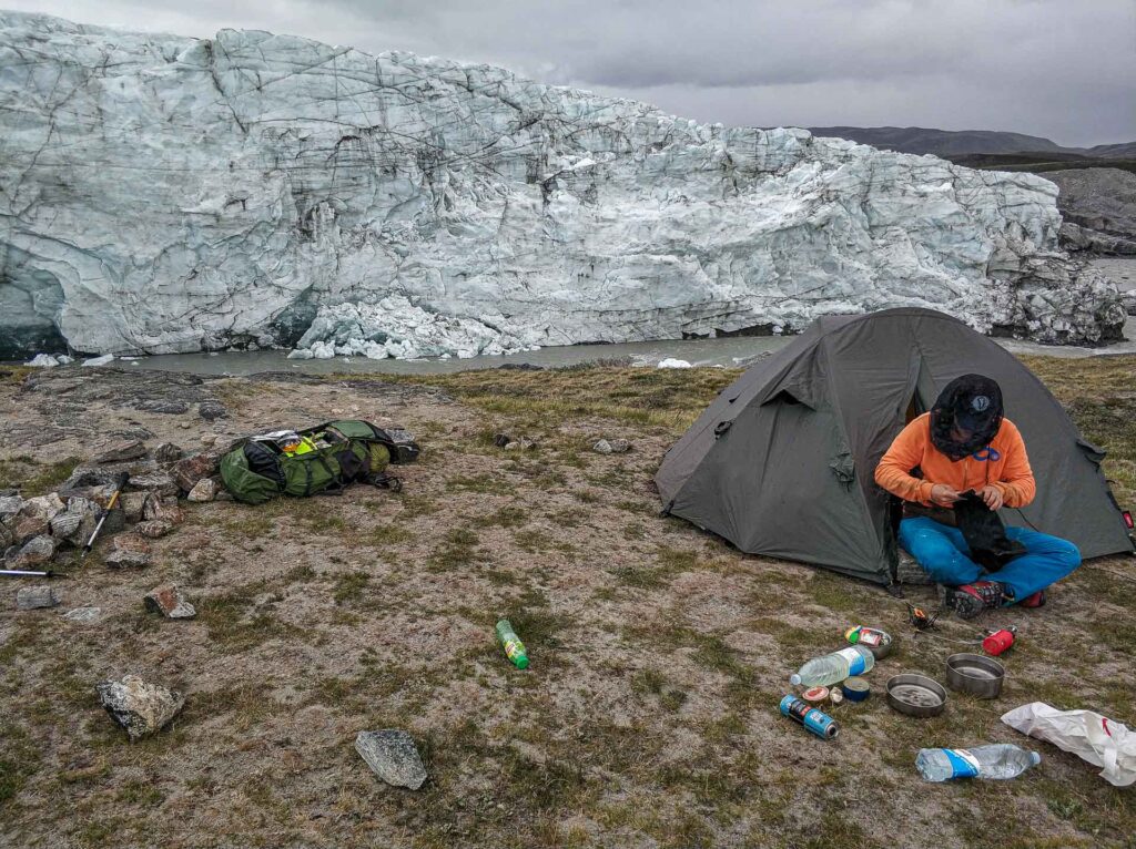
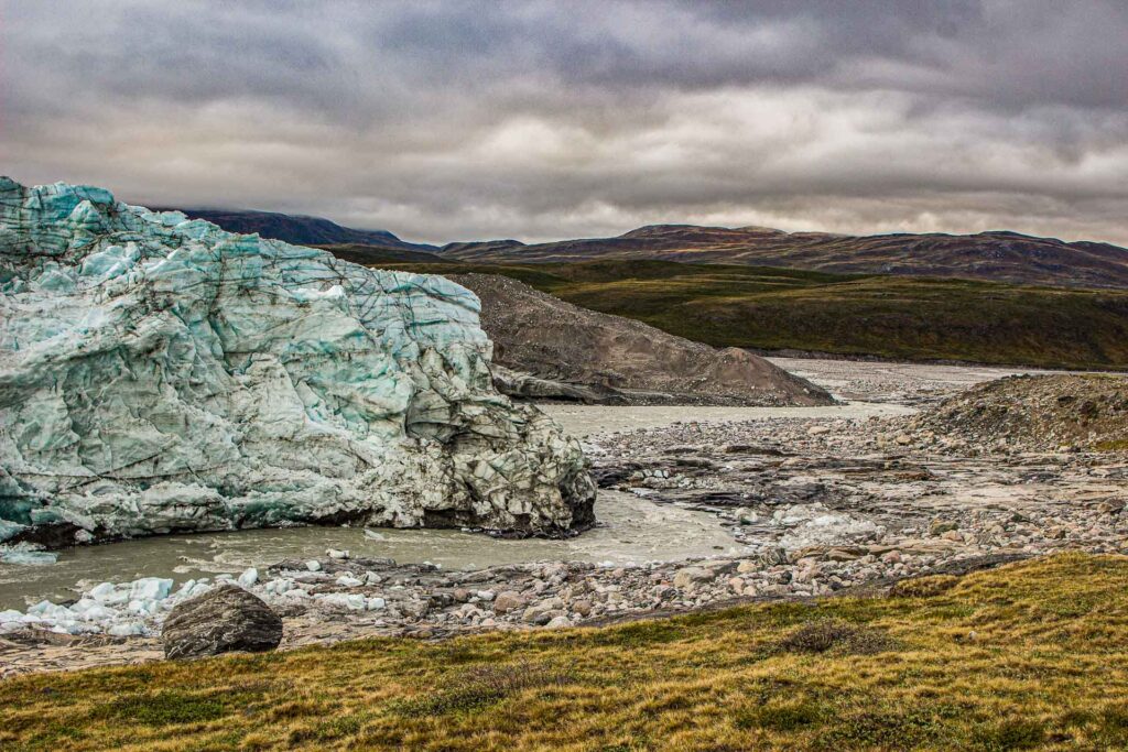
Pokud chcete trek absolvovat jak se sluší a patří, měli byste rozhodně začít od Ledovce! Cest, jak se dostat k ledovci, není mnoho. Štěrková cesta vedoucí z Kangerlussuaq k ledovci je v délce cca 30 km nejdelší cestou v Grónsku. Tímto směrem sice jezdí několik aut s pohonem 4×4, která vozí vědce vrtat do ledu, ale není jich mnoho a stopování může být složité. Jít pěšky je možnost, ale 30 km dost. My jsme jeli 8WD autobusem, který jezdí na celodenní výlet k ledovci. I presto, že jsme chtěli jen jednosměrnou jízdenku, tak byla za stejnou cenu a ne nízkou. Celodenní výlet stojí asi 625DKK a je v něm i čaj! Výlety se konají denně a není potřeba rezervace předem město je malinké a místo najdete snadno. Je to hned kousek od letiště. Autobus nás provezl po celé délce nejdelší silnici Grónska až na nejvzdálenější místo, dokud nenarazí na ledovou stěnu a slavný bod 660. To je místo ve výšce 660 m n. m. s nádherným výhledem na nekonečnou ledovou čepici. Na zpáteční cestě jsme zastavili autobus a vyskočili z něj spolu s udivenými hlasy ostatních turistů. Na okraj Russelova ledovce to nebyl moc daleko. Stáli jsme zde naprosto ohromeni a jen zírali na mohutnou modrou ledovou stěnu, ve které čas od času zapraskala obrovská masa ledu spolu s ohlušujícím zvukem jako při bouřce. Skvělý film k večeři, která byla vlastně plná komářích bílkovin.
29. 6. 2018 – DEN 1
Russel galcier – Kangerlussuaq – ACT
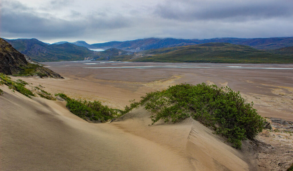
Probudil nás hluk padajícího ledu a díky časovému posunu a stále trvajícímu světlu začal trek již v 5 hodin ráno. Nejprve jsme šli podél Russelova ledovce dolů k vyschlému říčnímu korytu Orkendalen, které je vyhlášené jako nejsušší místo Grónska a také se mu říká „arktická poušť“. Přestože neustále mrholilo. Bylo ohromující přejít nejméně 5 km široké písečné koryto Orkendalenu a být sám tak daleko, kam až jen oko dohlédne. Cesta do Kangerlussuaqu byla dlouhá túra, ale po rychlé večeři jsme se rozhodli pokračovat v túře alespoň na začátek stezky Arctic Circle Trail. Nešlo to jinak než stale směrem na západ po asfaltové cestě podél Søndre Strømfjordu. Cestou jsme sledovali přistávající vojenská a zásobovací letadla. Pár aut kolem nás projelo, ale stopování, zdá se, nefunguje. Na konci silnice jsme odbočili doprava kolem satelitů v Atmospheric research centre a došli na travnatou cestu. Konečně jsme se dostali z dosahu aut a civilizace a dorazili na trail ACT. Rozbili jsme tábor nedaleko jezera po více než 40 km chůze.
30. 6. 2018 – Den 2
start ACT – Kattifik
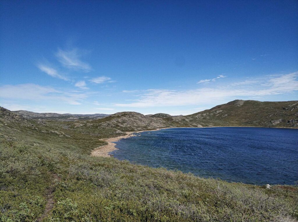
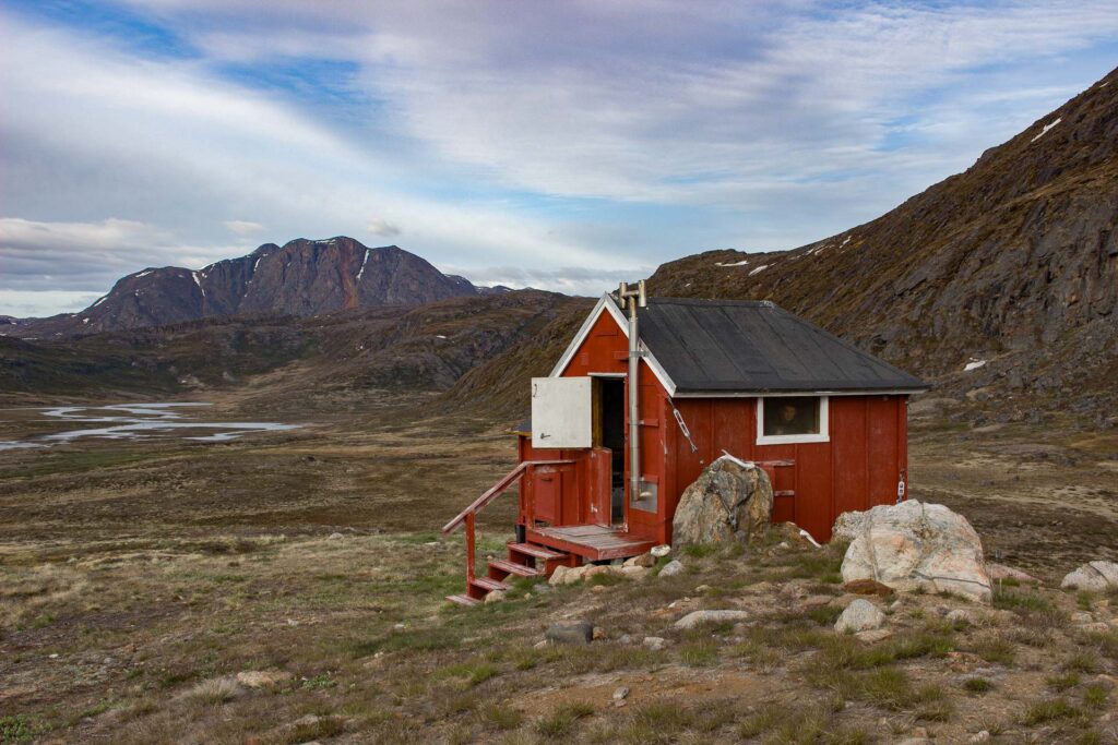
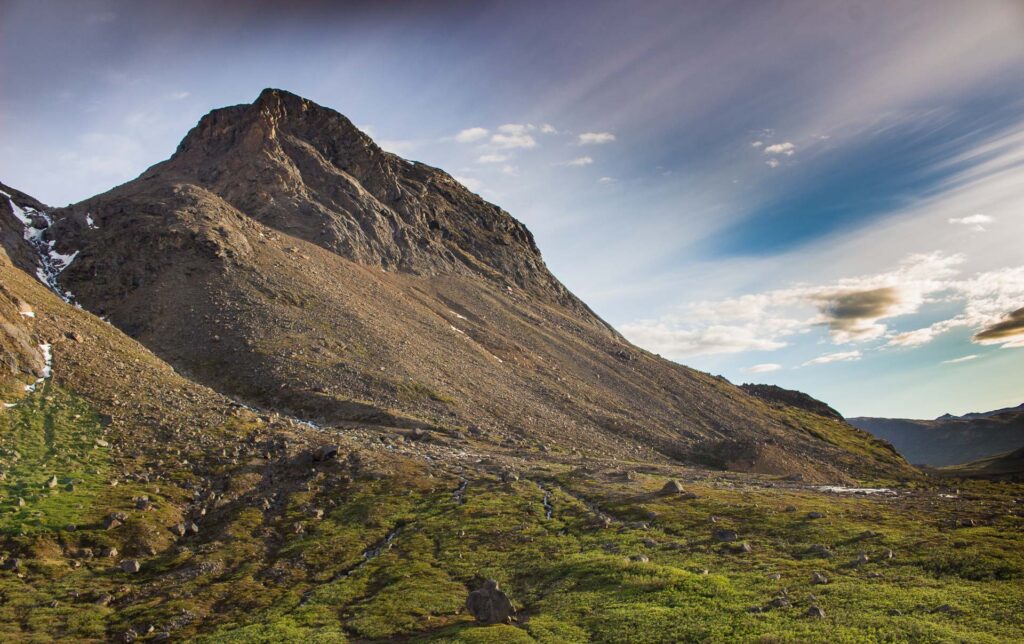
Slunečné ráno, horký arktický vzduch, trička, žádní komáři. Úzká divoká cesta procházející kolem mnoha mramorově modrých jezer rozdělených nízkými travnatými úseky. Krásné výhledy znásobené hluboce modrou oblohou. Bylo takové horko, že jsme neodolali a vykoupali se v nedalekém jezeře. Nebylo studené, spíše osvěžující. Zanedlouho jsme dorazili k lovecké chatě, která byla postavena z karavanu a nějakého dřeva. Zvláštní, jak jen někdo mohl tímto pro většinu vozidel nesjízdným terénem dovézt karavan, loď a materiál na stavbu chaty. Možná v zimě? Každopádně se tato chata dá použít jako místo k přenocování, protože je tu pár postelí a nikdo kolem. Za tímto místem se reliéf začal více vlnit a těžký batoh byl cítit ještě více. Byli jsme v polovině cesty, protože cílem byla chata Kattifik a brzy se dobré počasí změnilo ve větrné peklo s mrholením. Jen další teď už pravý důkaz, že počasí se rychle mění. Po strmém sestupu k chatě Kattifik nás čekalo nemilé překvapení. Potkali jsme první trekaře, ale vlastně ne na stezce, ale v chatě. Zase stan?
1. 7. 2018 – DEN 3
Kattifik – Canoe center
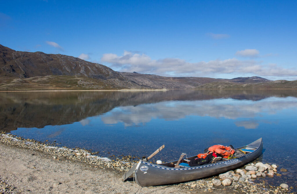
Jak jsme již včera předpovídali, probudili jsme se do deštivého dne. Strategicky jsme počkali, až se chata vyprázdní, a vlezli dovnitř na snídani a sbalení věcí do suchého prostředí. Žádné kánoe jsme nenašli a v tomto větrném počasí by to ani nebylo k smíchu, protože jsme slyšeli příběh o dívce, která pádlovala sama na kánoi, když přišel vítr a déšť. Voda jí naplnila loď a ona nebyla schopná pádlovat proti silnému větru a po boji se dostala ven zmrzlá úplně mokrá a vyčerpaná, ale přežila… Takže se nám vlastně poštěstilo jít pěšky po břehu jezera Amitsorsuaq cca 20 km po víceméně urovnané cestě jen přeskakováním kamenů. Věčný déšť a zima nás nutily k tomu, abychom se poměrně rychle dostali k další chatě. Naštěstí byla tato chata Canoe center obrovská a prázdná, takže jsme v ní mohli strávit noc čtením knihy o chatě a jejích příbězích a zároveň se kochat výhledem na jezero.
2. 7. 2018 – DEN 4
Center centre – chata Ikkattooq – Equalugaarniarfik
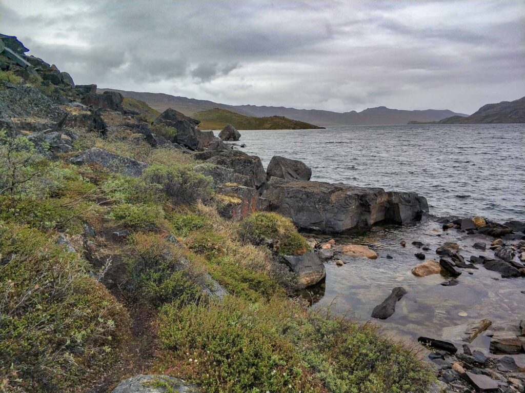
Další noční obrat počasí a tentokrát ale v pozitivním slova smylsu. Super klidné jezero jako zrcadlo, modrá obloha, ticho, sluneční paprsky hřející od rána a kovová kánoe čekající na nás na břehu jezera. Sám jsem se vydal na zkušební jízdu a zažil jsem něco opravdu nového. Ještě nikdy jsem neviděl tak křišťálově čistou vodu, která byla průhledná až do hloubky 10 metrů. Tato skutečnost ve mně vyvolávala zvláštní pocit strachu z pádu dolů. Něco jako strach z výšek, ale takovou hloubku jsem ještě nikdy ve vodě neviděl. Doufejme, že Grónsko nebude nikdy znečištěno a zachová si svou nedotčenost. Po snídani jsme tedy nasedli do kánoe a pokračovali asi dva kilometry k západnímu okraji jezera a kochali se zrcadlícími se horami odrážejícími se v klidném jezeře. Škoda, že jsme nemohli pádlovat celý den. Sbohem kánoe a pokračujeme bažinatou cestou k dalšímu jezeru Tasersuaq, kde bohužel žádná kánoe není. Odtud začala stezka stoupat na blízký hřeben a cesta se stává stále těžší a těžší. První velké stoupání bylo za námi a po dosažení chaty Ikkattooq nám byly dopřány odměňující výhledy na jezero. Byl to již dlouhý den, ale vzhledem k zužujícím se zdrojům potravy jsme se rozhodli opustit přístřesí a pokračovat. Po pár kilometrech nás ohromil další dechberoucí západ slunce and bažinatým údolím. Nezbývalo než sejít do údolí. Stále jsme pokračovali po stezce, ale brzy jsme narazili na docela divokou řeku se silným proudem, kterou jsme neměli jak překonat. Nebyl by to nejlepší nápad začít brodit se všemi batohy, které jsme chtěli udržet v suchu. Pokračovali jsme podél řeky v bahnitých mokřinách a snažili se najít nějaký způsob, jak přebrodit, ale bez výsledku. Pomalu jsme ztráceli naději a připravovali se na studenou sprchu, ale pak jsme si všimli skvělého dřevěného mostu (Nový most je vyznačen v mapě a souboru GPS). Netrvalo dlouho a došli jsme k další chatě. Pokud zde plánujete přenocovat, vezměte si vodu s sebou, žádná v okolí nění! Byli tam nějací Australané, takže jsme byli nuceni spát venku, alespoň že nechali venku vodu, abychom si ji mohli ukrást… Dlouhý den kolem 34 km.
3. 7. 2018 – DEN 5
Equalugaarniarfik – Innajuattup 1 hut
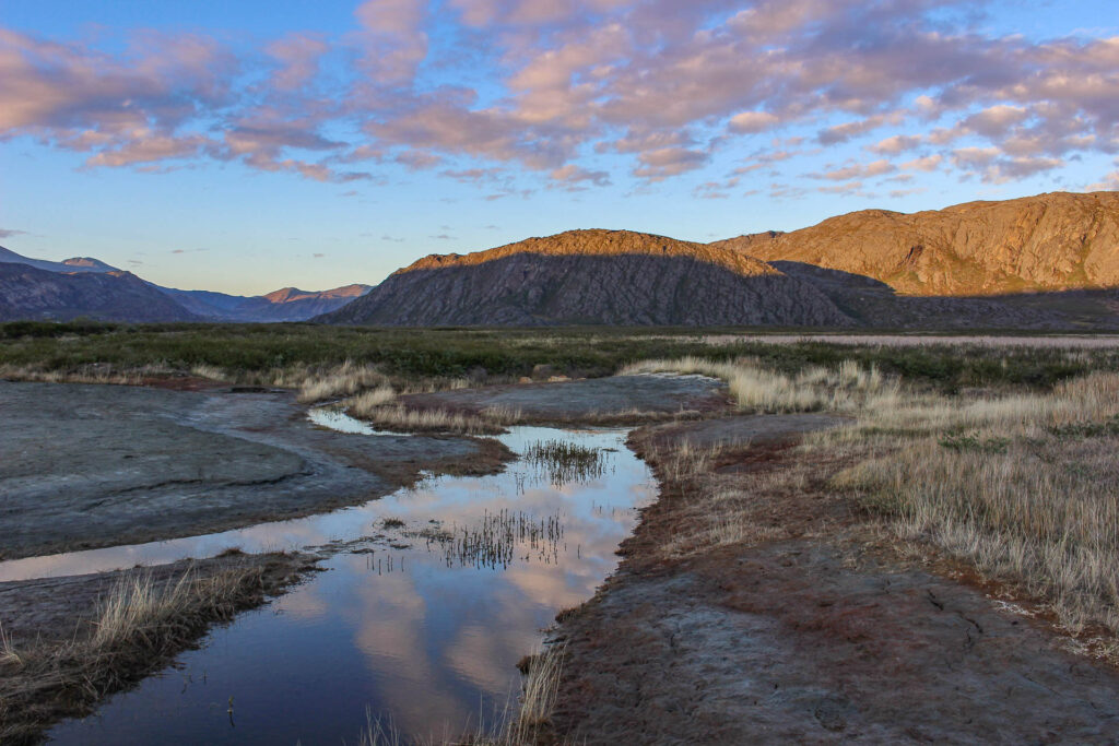
Po dlouhém spánku jsme se probudili tak pozdě, že chata byla již prázdná. K naší radosti jsme našli nějaké zbytky jídla. Vzali jsme si dva pytlíky sušeného jídla, které nás zachránilo od hladu až do konce cesty. Výstup z chaty Equalugaarniarfik byl vyčerpávající a výhledy na zamrzlé jezero nás opravdu nenaplnily větším nadšením. Co naplat, nedostatek kalorií si vybral svou daň. Sestup k jezeru a absolvování prvního zasněženého pole s vyčerpávajícím bojem s bažinatou cestou nás dovedlo k první chatě Innajuattup. Byla prázdná a trochu unavení jsme se rozhodli zůstat zde nejen kvůli skvělým výhledům, ale také kvůli funkčnímu olejovému topení a měkké matraci. Dnes „jen“ 18 kilometrů, ale nádhera!
4. 7. 2018 – DEN 6
chata Innajuattup 1 – chata Nerumaq – tábořiště
Všechno oblečení uschlo a opět krásné ranní počasí. S jistotou mohu říci, že snad nejkrásnější a to i příroda na ACT. Opět zrcadlové jezero a sluneční paprsky. Kousek od chaty byla další větší chata Innajuattup 2 a kousek od ní jsme byli nuceni přebrodit řeku. Chladno jako v Grónsku a i minuta v této studené řece měla za následek hlubokou bolest nohou. Náš celý dům na zádech bolest jen násobil. Naštěstí jen jednou. Procházka kolem krásného jezera s ostrovy bylo uspokojující. Bohužel místní všudypřítomné bažiny mi úplně zničily boty, které byly už takhle rozdrbané a začaly mi dost škodi. Do cíle nám zbývají už jen 2 dny, takže posledních 40 kilometrů musím tvrdě protrpět. Bos nepůjdu a druhé boty jsem si zkušeně nevzal. Docela rychle jsme dorazili k chatě Nerumaq v úzkém údolí, ale plně obsazené, takže jsme měli motivaci pokračovat. přes bažinaté cesty. Nakonec jsme měli štěstí a po 23 km pochodu jsme našli pěkné místo na stan.
5. 7. 2018 – DEN 7
Nerumaq – průsmykové tábořiště
První polovina dne nás vedla úzkým bažinatým údolím s dvojnásobným přechodem řeky. Po tomto přechodu jsme zjistili, že po břehu řeky se dá jít i bez brození. Bažinatá údolí s řekou nám odhalila život uvnitř řek a byli vidět pstruzi, kteří se vyhřívli na slunci. Sobi nás doprovázeli cestou k průsmyku od kterého jsme viděli fjord. To byl okamžik, kdy jsme si uvědomili, že jsme blízko pobřeží a take blízko civilizace. To nás moc nepotěšilo, ale bylo vidět pár chatek podél fjordu, kam se dá snáze dostat lodí. Opravdu pěkné odlehlé letní sídla. Protože další chata byla opět obsazená, pokračovali jsme do průsmyku, kde jsme zahlédli další chatu. Mptivování vidinou spánku v suchu jsme uháněli směrem k boudě. O to větší zklamání byl fakt, že místo vysnšné chaty s postelemi s nebesy byl jen suchý záchod. Vypadá to, že tento průsmyk je mezi místními docela oblíbený na oslavy a pobyt v přírodě s torchou alkoholu. Stan jsme si postavili tady, protože výhled na fjord byl nebývalý
6. 7. 2018 – DEN 8
tábořiště v průsmyku – Sisimiut
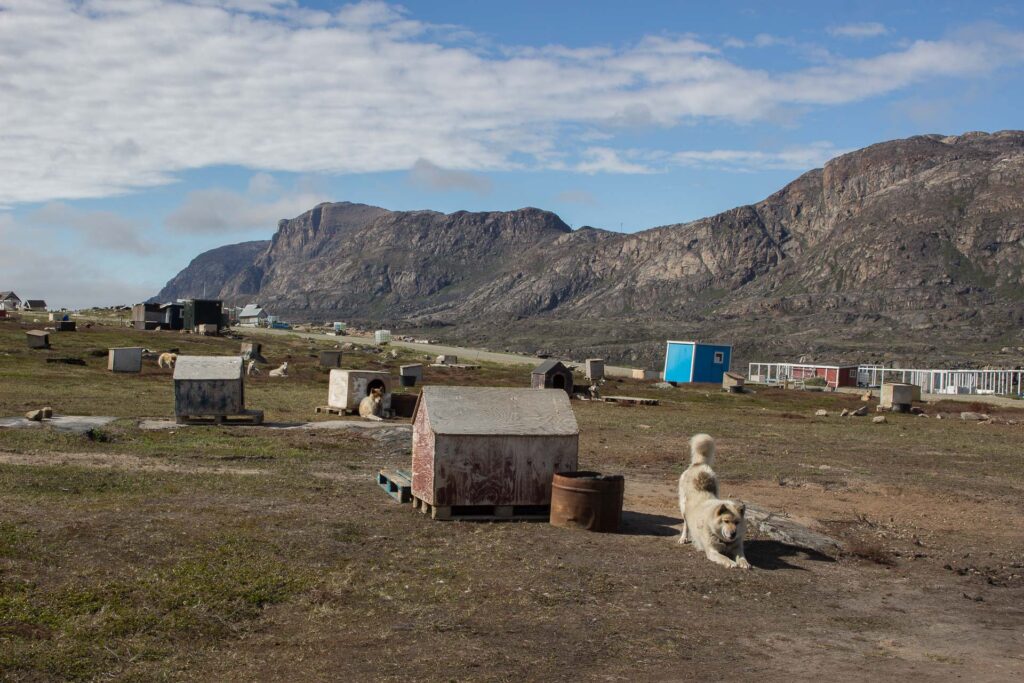
Poslední den před námi nebyl nejdelší, ale možná nejtěžší. Začátek dne přechodem mrazivých zasněžených polí s bažinami a řekami, poté docela náročný sestup do údolí. Brzy jsme v dalším průsmyku narazili na lyžařský vlek, který je nepopiratelnou známkou civilizace, a skutečně tomu tak bylo. už jen pár kilometrů sešupu dolů do Sisimiutu. Už z dálky nás vítal psí štěkot, protože v Grónsku je prý dvojnásobek psů než lidí. Opravdu poslední dva kilometry nás psi olizovali a vítali a skoro jsme byli přesvědčeni, že Sisimiut je město psů, ale po dalších pár krocích jsme se dostali na asfaltovou silnici, zahlédli autobusy a lidi, domy a supermarket se zmrzlinou. Sisimiut je druhé největší město v Grónsku, ale přesto má jen 5500 obyvatel a je velmi příjemné. Našli jsme penzion se sprchou a vyrazili za zábavou oslavit tento nebývalý úspěch.
Leave a reply